Mapping and Surveying
Plan Out Your Project in the Nampa or Boise, ID Area
Begin the planning phase with our mapping and surveying services
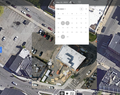
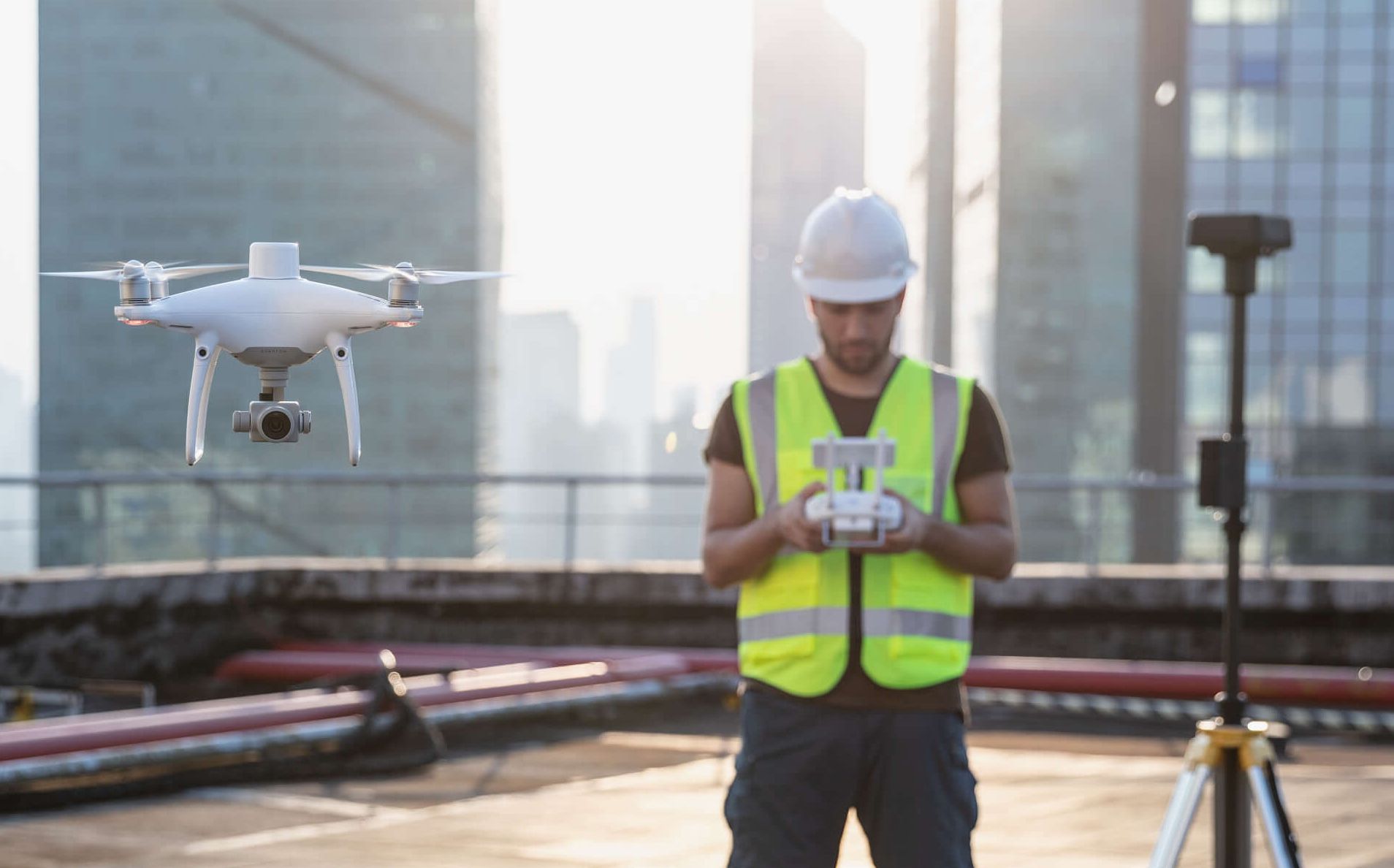
Drone-based mapping and surveying make it possible to create high-resolution maps and 3D models of construction sites, land and properties. With help from Terravata, you can get access to these accurate services. We offer drone mapping services throughout the Nampa and Boise, ID area. We’ll begin with a pre-flight survey to plan your project and use our drones to capture the data you need.
Contact us now for drone-based mapping and surveying services.
Providing aerial mapping services for your project
Creating a plan that accommodates the size, slope and shape of your property is essential. Thankfully, we’ll be glad to assist you. We capture aerial images and data for...
- 3D models
- Orthomosaics
- Topographical surveys
- The creation of geo-referenced maps
With the data and images we provide in hand, you can plan, monitor and manage your land or construction project. Discuss your project with one of our experts today.
Slide title
Write your caption hereButton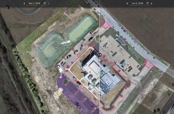
Slide title
Write your caption hereButton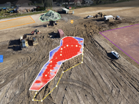
Slide title
Write your caption hereButton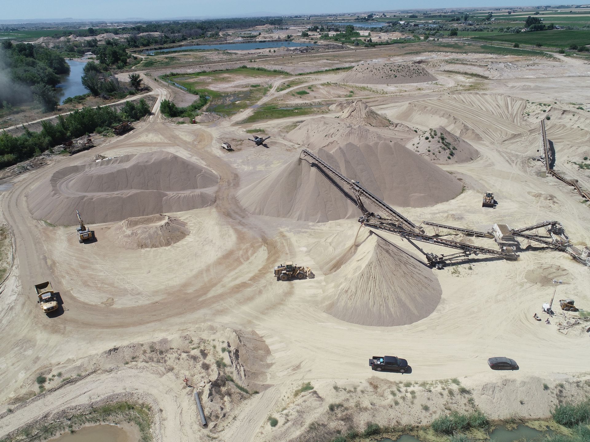
Slide title
Write your caption hereButton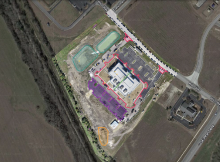
Slide title
Write your caption hereButton
Slide title
Write your caption hereButton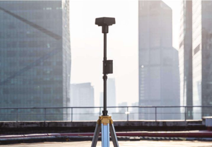
Slide title
Write your caption hereButton
Precision Positioning with RTK GPS
RTK (Real-Time Kinematic) GPS technology provides highly precise positioning data, making it a transformative tool in many industries. By utilizing real-time correction data from a nearby base station, RTK achieves centimeter-level accuracy, ensuring unmatched reliability for projects requiring exact location measurements. Below are three key applications where RTK is especially beneficial:
- Physical Security Equipment Mapping
- Precision Agriculture Field Mapping
- Infrastructure and Utility Mapping
Enhanced Security Layout Mapping: For physical security installations, RTK GPS ensures precise placement and alignment of devices such as cameras, sensors, and access points. This technology ensures optimal coverage and reduces the risk of blind spots, contributing to robust and efficient security systems.
With its real-time updates and extreme accuracy, RTK GPS significantly improves project outcomes by minimizing errors, enhancing efficiency, and reducing costs across various industries. Whether you’re optimizing a farm, designing an infrastructure project, or improving a security layout, RTK delivers the precision you need to succeed.