
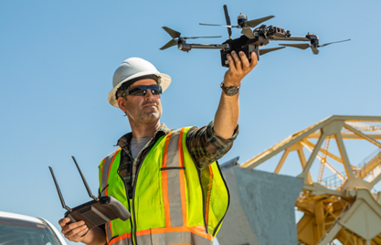
Industries
Aerial Photography
Elevating Imagery with Drone Technology
Drones revolutionize aerial photography by capturing stunning, high-resolution images from unique perspectives that were previously inaccessible. Whether you're looking to showcase real estate, events, or landscapes, drones provide dynamic angles and breathtaking visuals. With 4K HD video and precise control, drones offer a cost-effective solution for professional-grade photography, allowing businesses and individuals to present their projects with unparalleled quality.
Key Benefits:
- Capture aerial angles and wide-area shots
- High-resolution imagery and 4K video quality
- Ideal for creative projects, marketing, and real estate
Slide title
Write your caption hereButton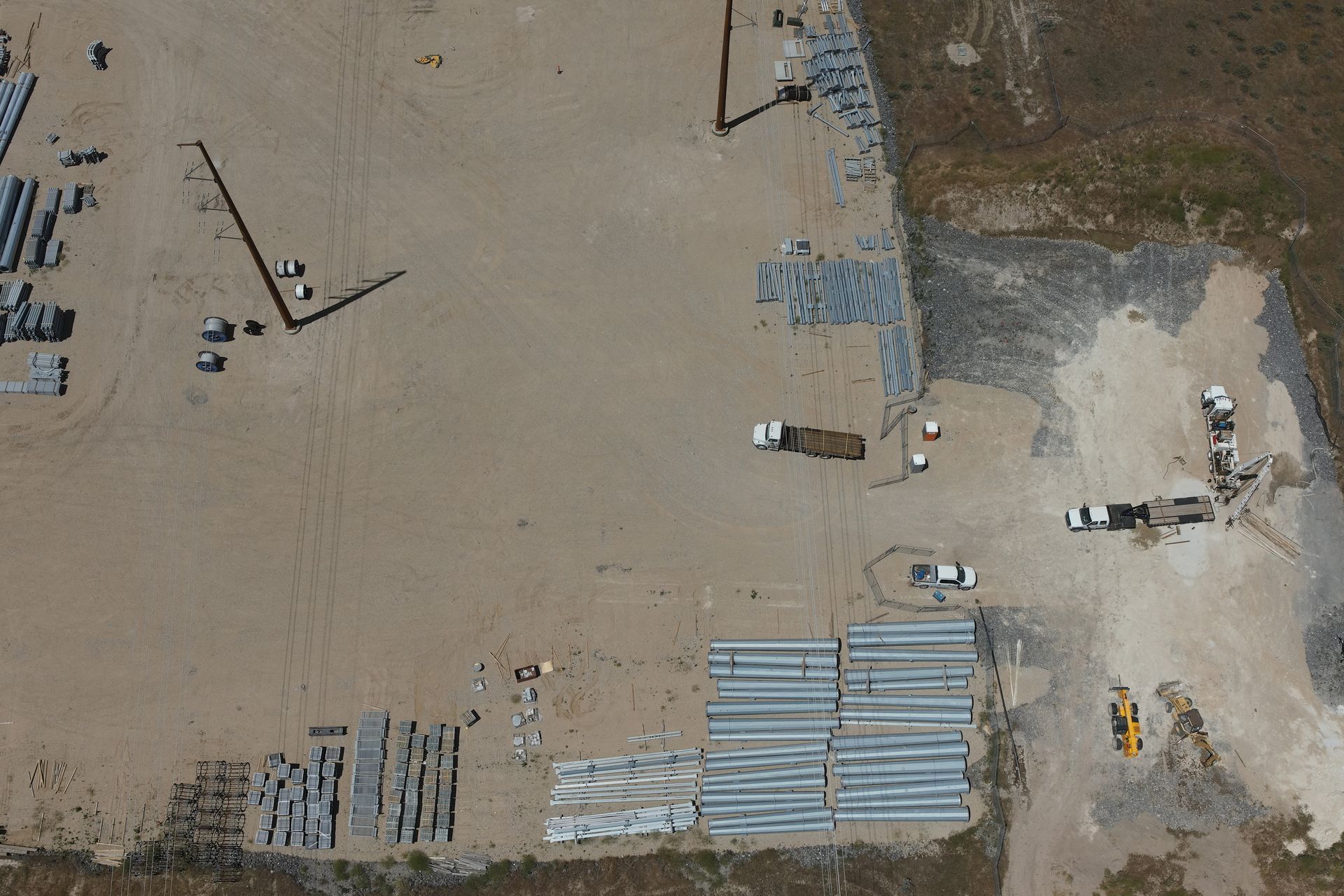
Slide title
Write your caption hereButton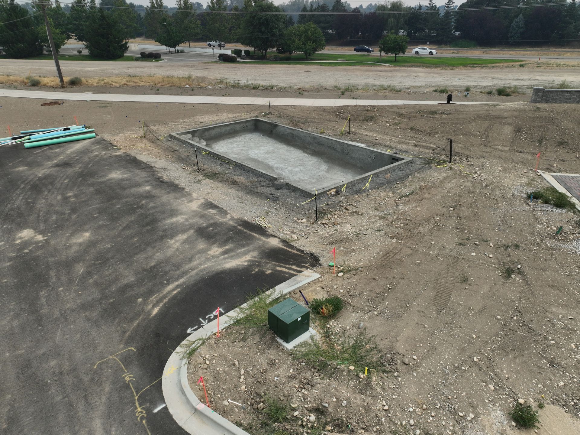
Slide title
Write your caption hereButton
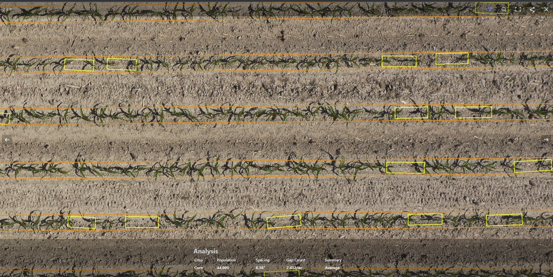
Agriculture
Optimizing Agricultural Operations with Drones
Drones have become essential tools in modern agriculture, providing farmers with real-time insights into crop health, irrigation, and soil conditions. By flying over vast fields, drones can quickly assess plant health, count crops, and monitor growth stages, helping farmers make data-driven decisions. With the ability to cover large areas in a fraction of the time, drones reduce labor costs while improving crop management, resulting in higher yields and more sustainable farming practices.
Key Benefits:
- Real-time crop health monitoring and analysis
- Efficient plant counting, stand assessment, and irrigation management
- Reduced labor costs and increased operational efficiency
Slide title
Write your caption hereButton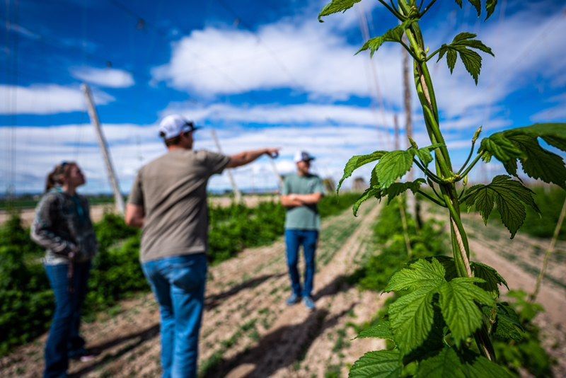
Slide title
Write your caption hereButton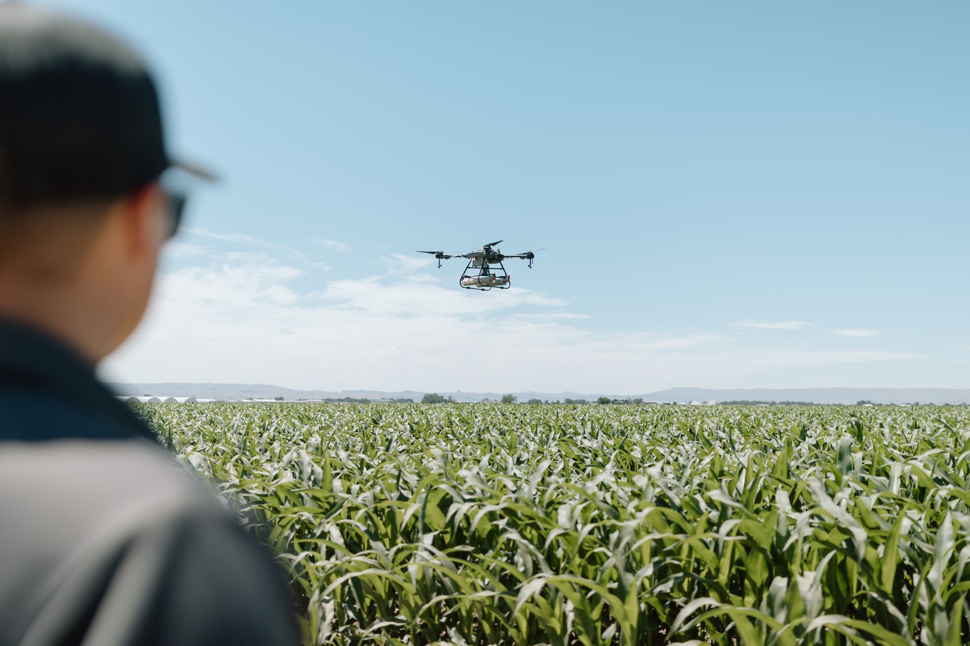
Slide title
Write your caption hereButton
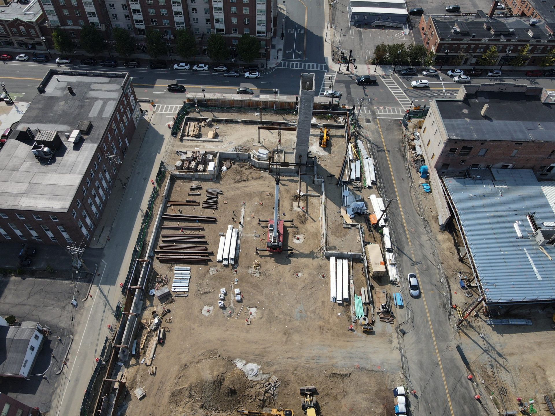
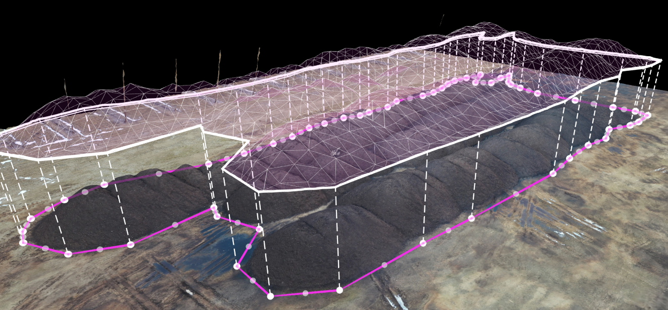
Construction
Improving Construction Efficiency with Drone Technology
Drones have transformed the construction industry by providing fast, accurate data collection for site surveying, progress monitoring, and safety inspections. By offering high-resolution aerial views, drones allow project managers to oversee construction sites more effectively and make real-time adjustments. The ability to capture 3D models and perform industrial photogrammetry ensures precise planning, helping projects stay on schedule and reducing the risk of costly errors.
Key Benefits:
- Accurate site surveying and progress monitoring
- Enhanced safety with aerial inspections
- 3D modeling and photogrammetry for precision
Slide title
Write your caption hereButton
Slide title
Write your caption hereButton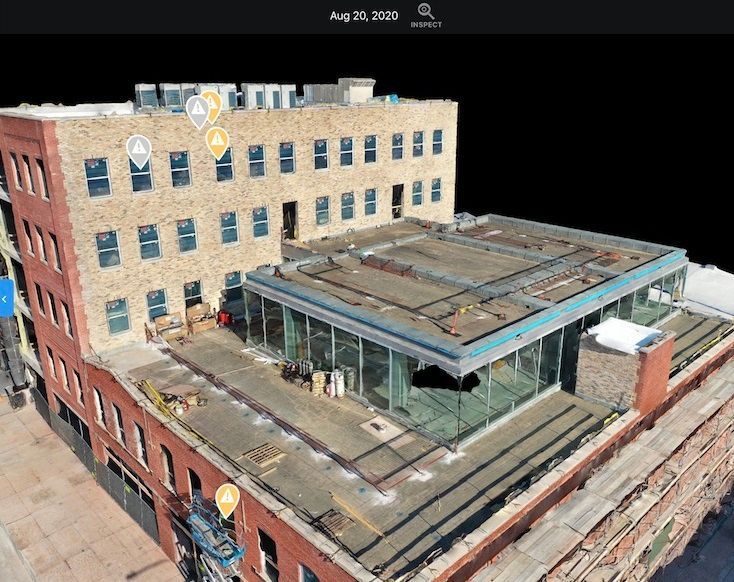
Slide title
Write your caption hereButton
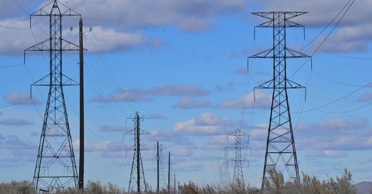
Energy
Enhancing Energy Sector Operations with Drones
Drones offer unmatched efficiency in the energy industry, allowing for rapid inspections of power lines, wind turbines, and solar panels without the need for shutdowns or dangerous manual inspections. Equipped with thermal imaging, drones can identify hotspots or defects in energy infrastructure, enabling timely maintenance. By using drones, energy companies can minimize downtime, reduce costs, and improve safety in high-risk environments.
Key Benefits:
- Safe, efficient inspections of energy infrastructure
- Thermal imaging for early detection of issues
- Minimized downtime and operational disruptions
Slide title
Write your caption hereButton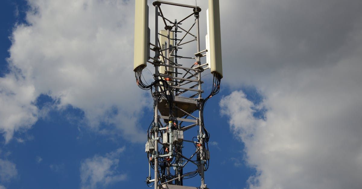
Slide title
Write your caption hereButton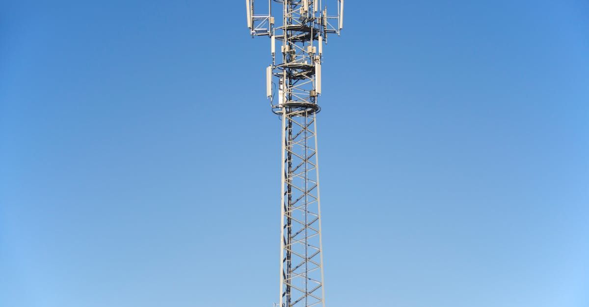
Slide title
Write your caption hereButton
Engineering
Advancing Engineering with Drone Technology
In the engineering field, drones provide precise aerial data for surveying, mapping, and modeling. By offering detailed topographic maps and 3D models, drones enable engineers to visualize projects in new ways and ensure accurate planning and execution. Drones can also monitor project progress, capture aerial views of construction sites, and help identify potential problems early, reducing the likelihood of delays or cost overruns.
Key Benefits:
- Enhanced design and planning with 3D mapping and models
- Real-time project monitoring and progress tracking
- Improved accuracy and efficiency in construction projects
Slide title
Write your caption hereButton
Slide title
Write your caption hereButton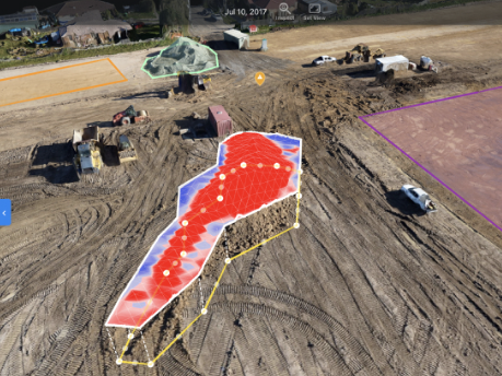
Slide title
Write your caption hereButton
Infrastructure
Streamlining Infrastructure Projects with Drones
Drones are revolutionizing infrastructure management by providing detailed aerial inspections of bridges, roads, railways, and more. By offering access to hard-to-reach areas and collecting high-resolution data quickly, drones reduce the need for dangerous manual inspections. This technology helps ensure the safety and stability of infrastructure projects while minimizing disruptions and lowering inspection costs.
Key Benefits:
- Faster, safer inspections of infrastructure
- High-resolution data for maintenance and repairs
- Reduced costs and operational disruptions
Slide title
Write your caption hereButton
Slide title
Write your caption hereButton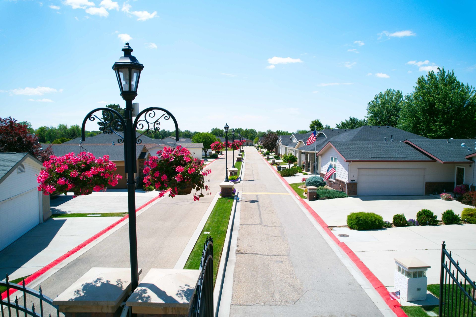
Slide title
Write your caption hereButton
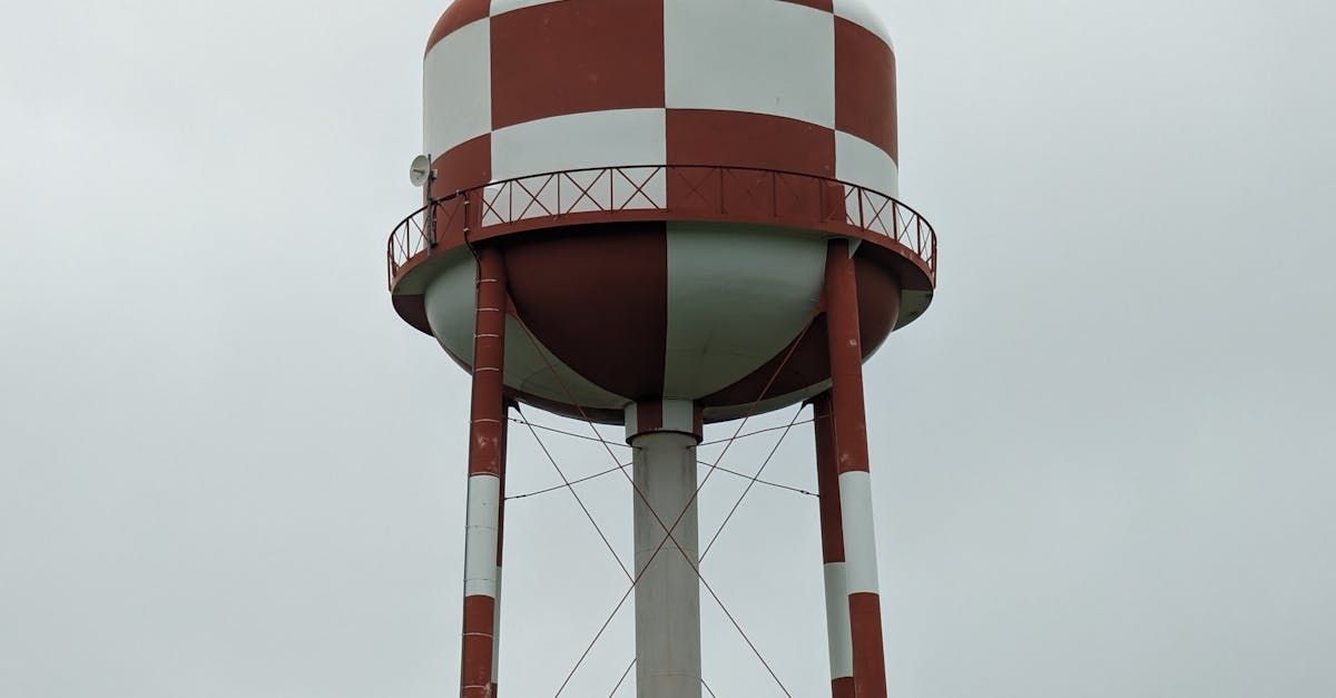
Inspections
Enhancing Inspection Processes with Drones
Drones allow for faster, safer, and more cost-effective inspections of buildings, rooftops, storage tanks, and other critical infrastructure. By capturing high-definition aerial images, drones provide detailed information on the condition of structures, enabling more accurate assessments without putting workers at risk. With drones, inspection processes become quicker, safer, and more efficient, helping to prevent costly downtime.
Key Benefits:
- High-resolution aerial imagery for detailed inspections
- Reduced risk and improved safety for workers
- Faster, more cost-effective inspection processes
Slide title
Write your caption hereButton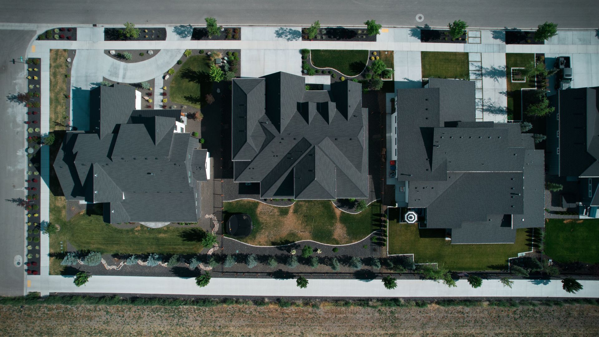
Slide title
Write your caption hereButton
Slide title
Write your caption hereButton
Oil & Gas
Optimizing Oil & Gas Operations with Drone Technology
In the oil and gas industry, drones are vital for conducting inspections of pipelines, rigs, and refineries. Drones can access remote or hazardous areas, providing real-time data to monitor structural integrity, detect leaks, and ensure compliance with safety regulations. Using drones minimizes the need for manual labor in dangerous environments, while also speeding up inspections and reducing operational costs.
Key Benefits:
- Safe, efficient inspections of pipelines and rigs
- Real-time monitoring for leak detection and safety compliance
- Reduced operational costs and improved safety
Slide title
Write your caption hereButton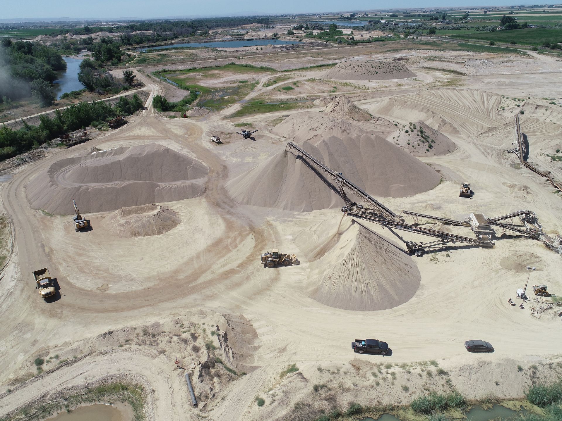
Slide title
Write your caption hereButton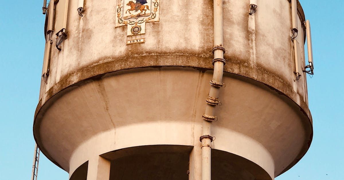
Slide title
Write your caption hereButton
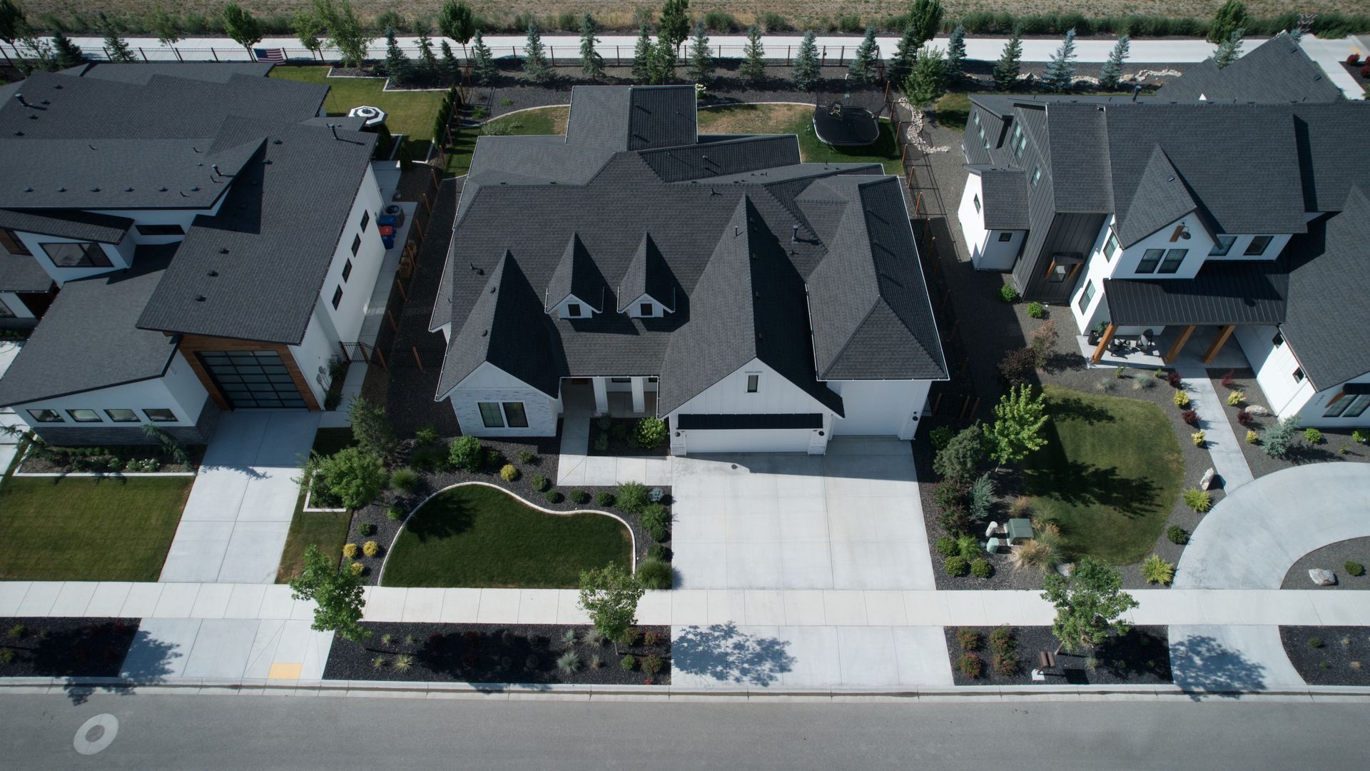
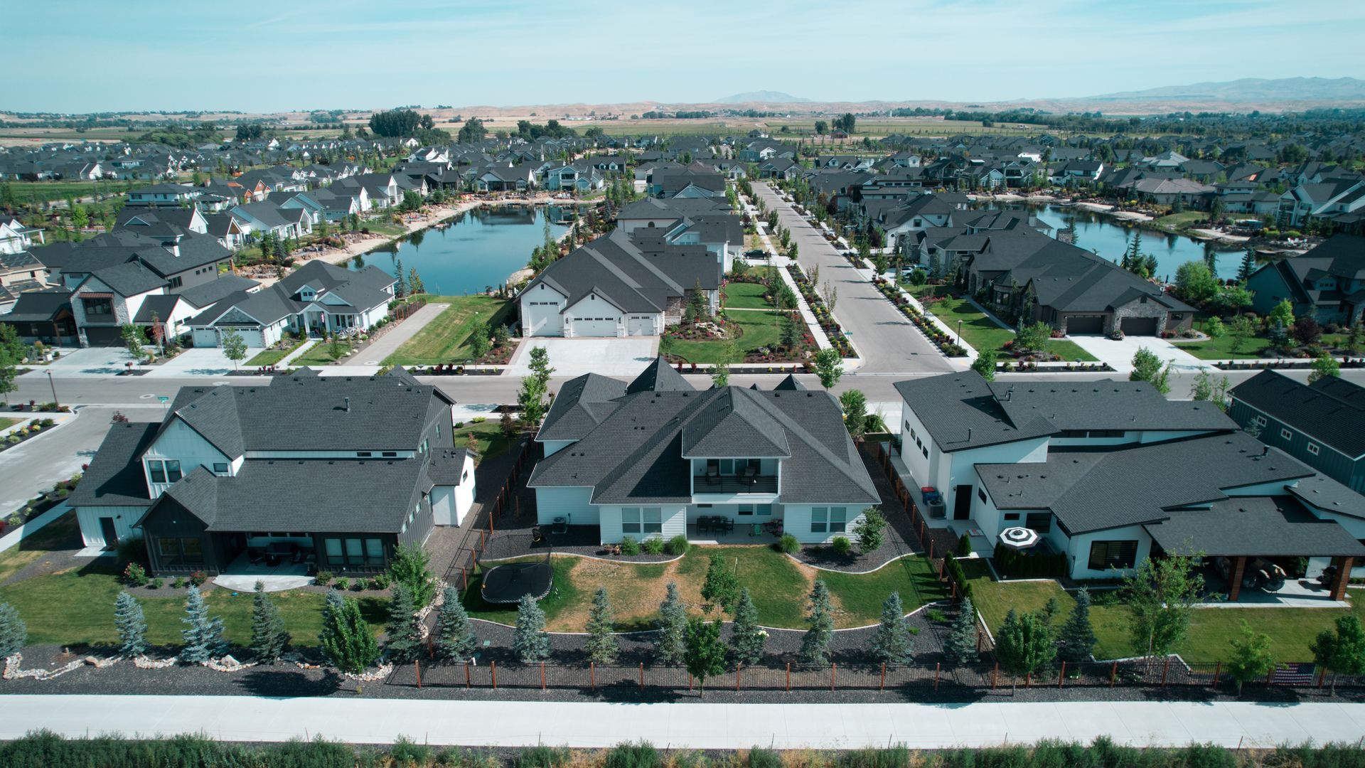
Real Estate
Elevating Real Estate Marketing with Drone Imagery
Drones offer an innovative way to showcase real estate properties from stunning aerial perspectives. By capturing high-resolution images and 4K video, drones allow real estate agents and property managers to present properties in a visually compelling way. This technology is particularly valuable for large estates, commercial properties, and developments, helping attract buyers and investors by offering a complete view of the location and surrounding areas.
Key Benefits:
- High-resolution aerial views of properties
- Dynamic visuals for large estates, commercial buildings, and developments
- Effective marketing tool for attracting buyers and investors
Slide title
Write your caption hereButton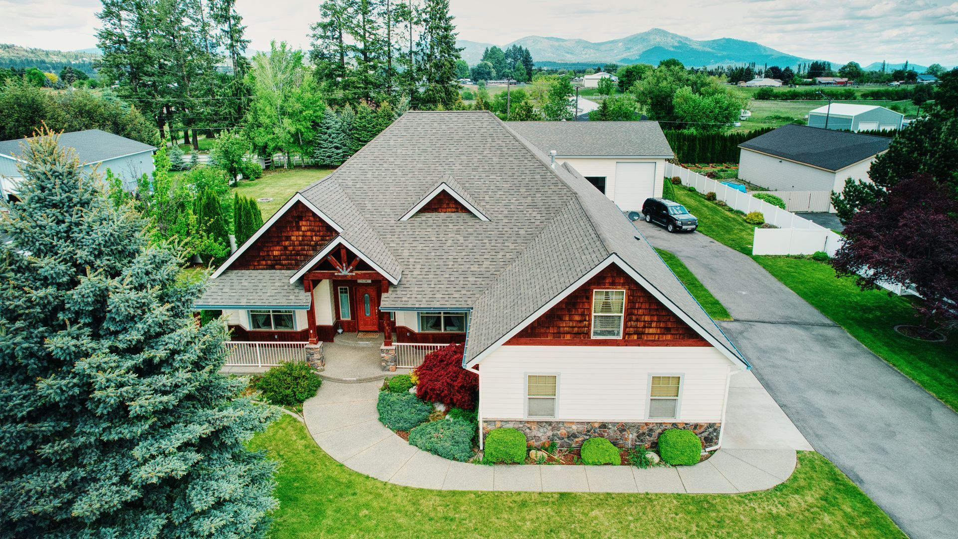
Slide title
Write your caption hereButton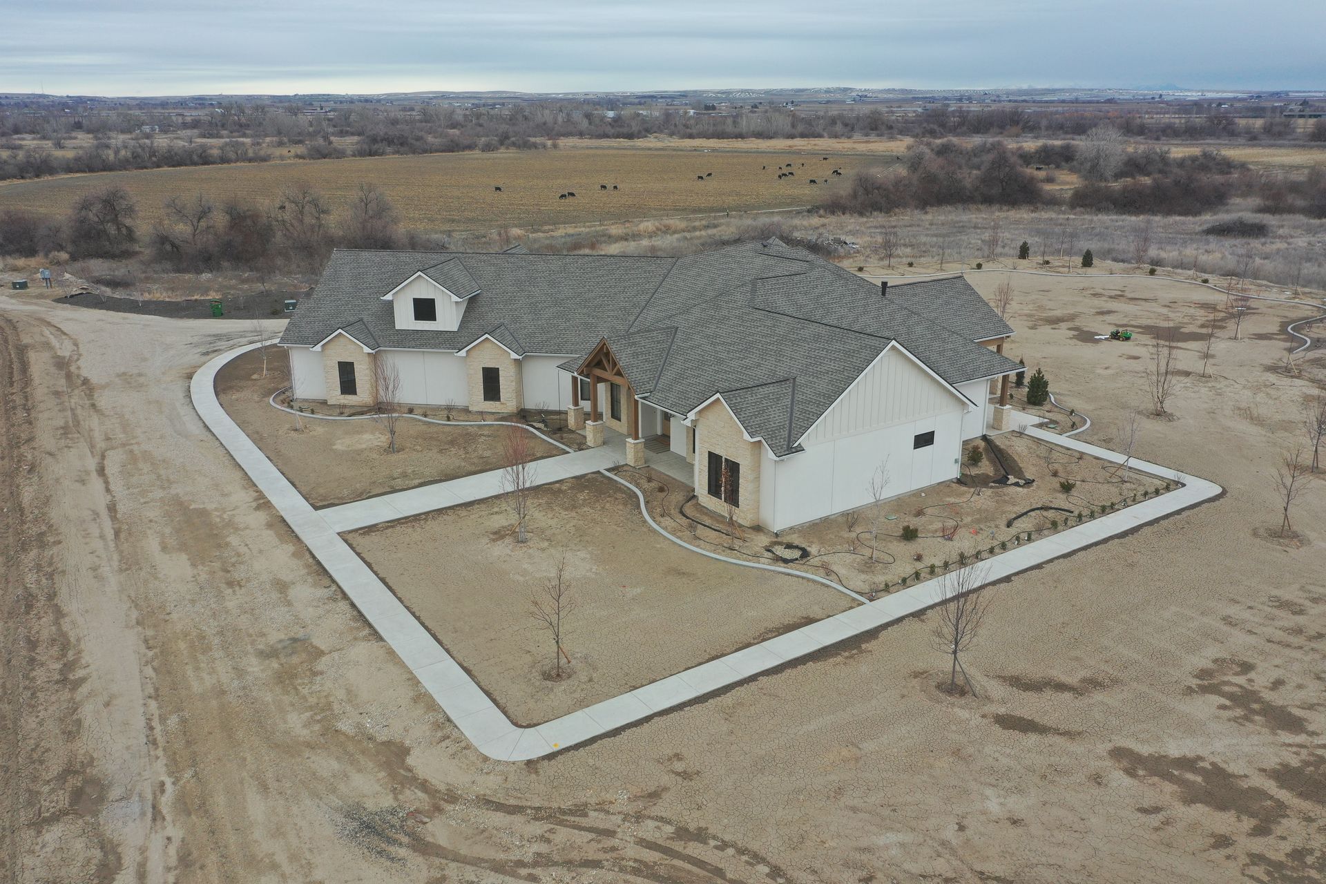
Slide title
Write your caption hereButton
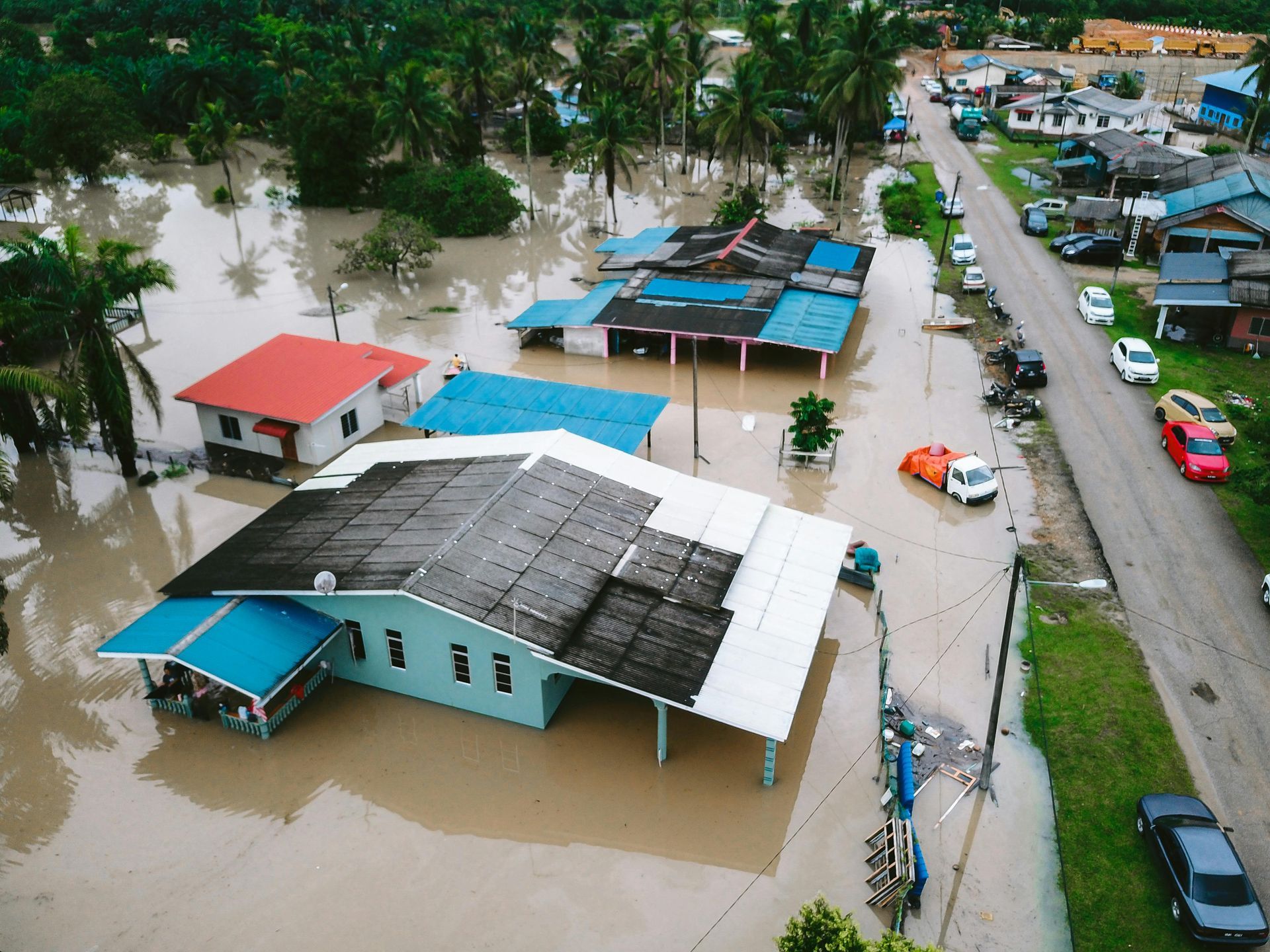
Search and Rescue
Improving Search and Rescue Efforts with Drones
Drones play a crucial role in search and rescue operations, offering real-time aerial views of large areas in a fraction of the time it takes for ground teams to cover the same distance. Equipped with thermal cameras and GPS technology, drones can quickly locate missing persons or assess disaster-stricken areas, providing invaluable information to rescue teams and increasing the chances of successful outcomes.
Key Benefits:
- Fast aerial search coverage with thermal imaging
- Real-time data for efficient rescue operations
- Increased success rates in finding missing persons
Slide title
Write your caption hereButton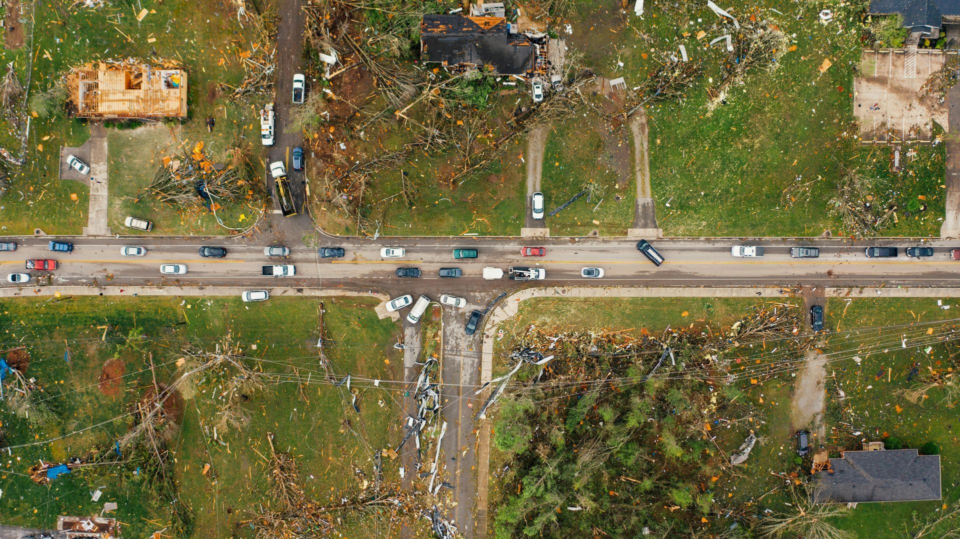
Slide title
Write your caption hereButton
Slide title
Write your caption hereButton
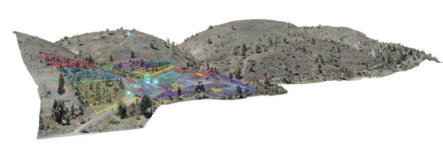
Mapping and Surveying
Enhancing Mapping and Surveying with Drone Technology
Drones offer precision and speed in mapping and surveying, capturing detailed aerial images that can be used to create geo-referenced maps and 3D models. This data is crucial for land development, urban planning, and environmental monitoring. Drones provide a cost-effective and efficient solution to traditional surveying methods, covering large areas quickly and with more accuracy.
Key Benefits:
- Geo-referenced maps and 3D models
- Faster and more accurate data collection
- Ideal for land development and urban planning
-
Slide title
Write your caption hereButton 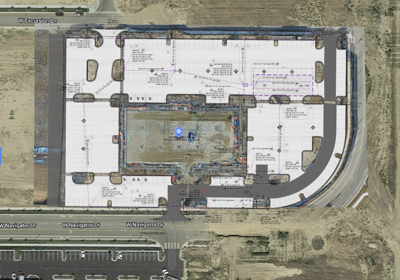
Slide title
Write your caption hereButton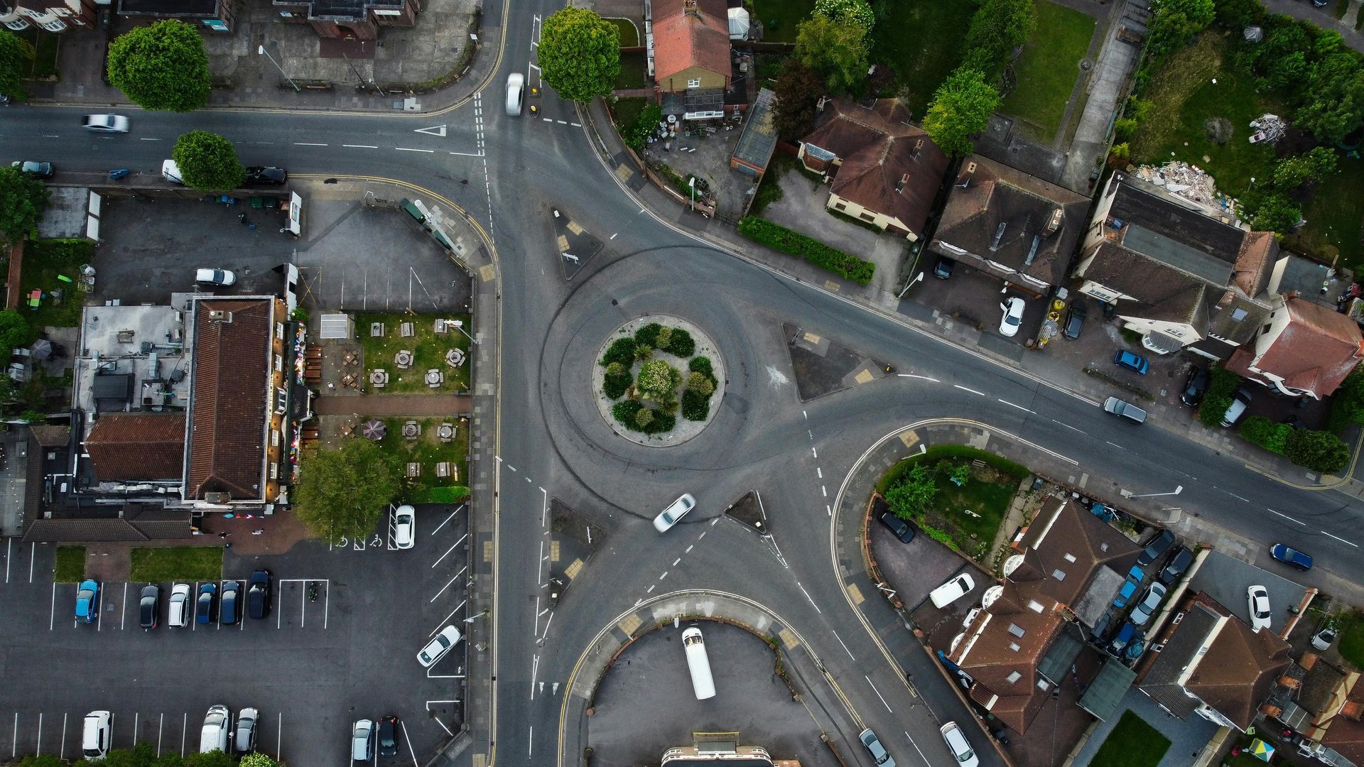
Slide title
Write your caption hereButton
Environmental Monitoring
Supporting Environmental Monitoring with Drones
Drones provide an invaluable tool for environmental monitoring, allowing researchers and environmentalists to track changes in ecosystems, monitor wildlife, and assess the impact of human activities. With high-resolution cameras and sensors, drones can capture data from hard-to-reach areas, offering a non-invasive method of environmental assessment. This technology helps promote sustainability by providing real-time insights into environmental conditions.
Key Benefits:
- Non-invasive environmental monitoring
- Real-time data collection for sustainability efforts
- Access to remote or difficult-to-reach areas
Slide title
Write your caption hereButton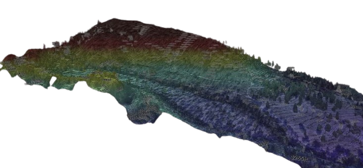
Slide title
Write your caption hereButton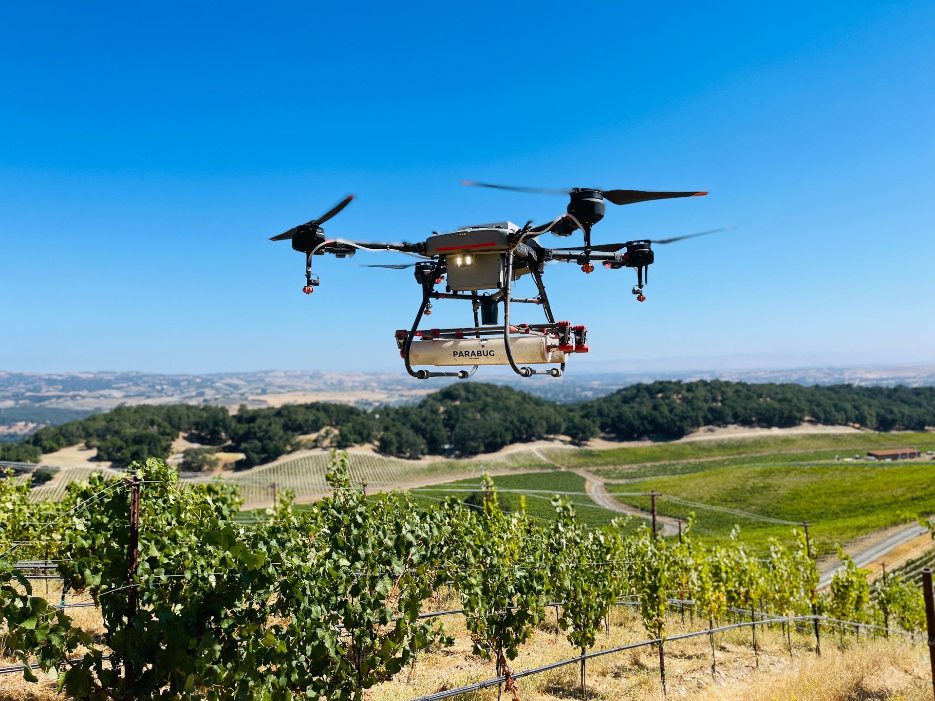
Slide title
Write your caption hereButton